
The Best GPS Systems for Journey Management in 2026
A practical, safety-first comparison of the top GPS and satellite tracking devices for personnel, vehicles, and lone workers.
Journey management only works if you can actually see where your people are. A well-built journey management plan — check-in schedules, route risk assessments, defined stop points, escalation procedures — is only as strong as the tracking technology sitting underneath it. If a driver goes off-route in a dead cellular zone, or a field technician doesn't check in from a remote site, your journey management module needs a live, reliable data feed to trigger the right alert at the right time.
That's where GPS hardware comes in. Not every GPS device is built for the same job. Some are designed for hikers who occasionally need an SOS button. Others are purpose-built for enterprise fleets running hundreds of vehicles across regions with patchy cellular coverage. Choosing the wrong category of device for your operation is one of the most common — and most expensive — mistakes safety and operations teams make when standing up a journey management program.
This guide breaks down five of the most widely used GPS and satellite tracking systems for journey management, with a closer look at Garmin, since it remains the most common device our customers pair with their SafetyIQ Journey Management Software. We'll cover how each device fits into a journey management workflow, where it shines, where it falls short, and how to think about matching hardware to your actual risk profile.
Quick context: Journey management hardware generally falls into two categories — satellite communicators (built for personnel and lone workers, often with two-way messaging and SOS) and vehicle telematics devices (built for fleets, installed in vehicles, and focused on continuous location, driving behavior, and diagnostics). Most mature journey management programs end up using a mix of both.
Why GPS Hardware Choice Matters for Journey Management
A journey management module is a decision-support system. It takes location data, compares it against a planned route and expected check-in schedule, and flags deviations — a missed check-in, an unexpected stop, a driver going off the approved corridor. None of that logic matters if the underlying position data is delayed, inaccurate, or drops out the moment a worker leaves cellular range.
Coverage Gaps Are the Real Risk
Most GPS tracking failures in the field aren't caused by bad software — they're caused by relying on cellular-only hardware in areas that don't have reliable cellular coverage. Remote worksites, rural highways, mining and forestry operations, and cross-border freight routes routinely pass through zones with no signal at all. If your journey management plan depends on a device that goes silent the moment coverage drops, you've built a false sense of security into your safety program.
Update Frequency Changes What You Can Actually Do
A device that pings its location every 10 minutes is fine for general awareness. It's not fine if your journey management plan needs to detect a vehicle rollover or a lone worker who's stopped moving within minutes, not a quarter of an hour. Update frequency, battery trade-offs, and how a device behaves during an SOS event are all things that need to match the actual risk level of the journey being managed.
Two-Way Communication Changes the Outcome
One-way tracking tells you where someone is. Two-way communication lets you actually talk to them — confirm they're safe, get more detail on an incident, or send updated instructions if a route needs to change mid-journey. For lone and remote workers, this distinction is often the difference between a fast, informed response and a slow, uncertain one.
The 5 Best GPS Systems for Journey Management
Below are five of the most reliable, widely deployed GPS and satellite tracking systems currently used for journey management and personnel safety, ranging from ultralight personal communicators to enterprise fleet telematics.
1. Garmin inReach Mini 2 (and the broader inReach line)
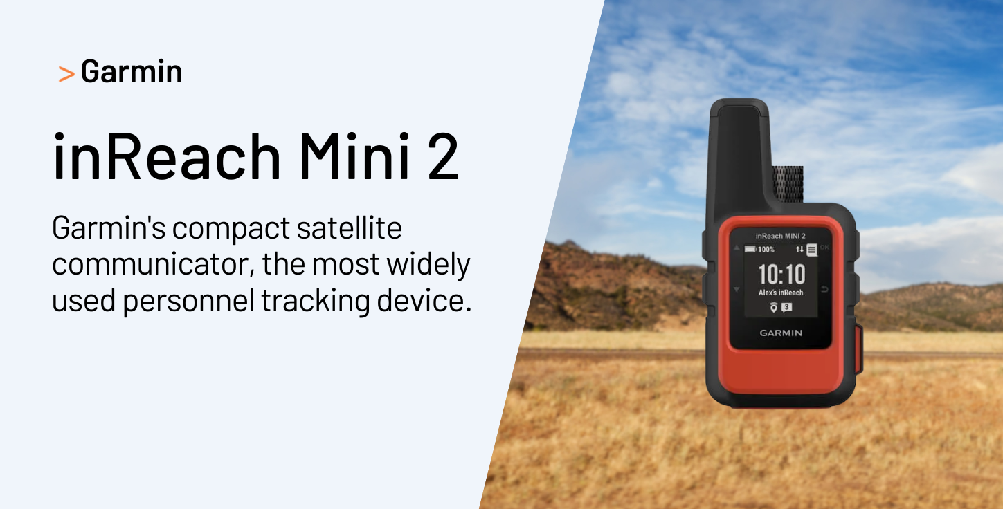
Garmin is, by a wide margin, the device most commonly used by SafetyIQ customers for personnel tracking within journey management plans, and it's easy to see why. Garmin dominates the satellite communicator market, and the inReach Mini is a compact, lightweight device packed with essential safety features, from location tracking to two-way messaging and SOS. The tracking feature records track points and transmits them over the Iridium satellite network at a set send interval, with those points appearing on a linked tracking webpage.
The device is rugged and impact-resistant, with an IPX7 water rating, and offers a 30-minute tracking interval that extends battery life to around 30 days in full sky view, or roughly 10 days under moderate tree cover. Battery life adjusts depending on tracking interval — up to 14 days at the default 10-minute setting, and up to 30 days at the 30-minute interval. Because it runs on the Iridium network, it provides secure, encrypted tracking and two-way communication with genuinely global, pole-to-pole coverage rather than relying on regional satellite constellations.
For journey management purposes, Garmin's strength is its balance: it's small enough for individual field workers to carry every day, rugged enough for harsh environments, and its two-way messaging means a dispatcher can actually communicate with a worker who's gone off-route, not just see a dot on a map. The trade-off is that it's built primarily as a personal communicator rather than a vehicle-installed system, so fleets typically pair it with a separate in-vehicle telematics device.
2. SPOT X (Globalstar)
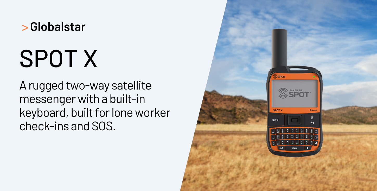
The SPOT X is a two-way satellite messenger that lets users send and receive text messages, share GPS locations, and contact emergency services outside of cellular coverage, using a built-in backlit physical keyboard so messages can be composed directly on the device. Globalstar positions its SPOT lineup specifically around personnel safety management, with a one-touch SOS button that connects users to local emergency response teams around the world.
Location accuracy on SPOT X is typically within about 20 feet, and the device is well suited to commercial lone worker safety applications, as well as workers who regularly operate outside cellular range. Compared to Garmin's inReach line, SPOT X tends to be positioned as a more budget-friendly two-way option, with a dedicated physical keyboard being a notable differentiator for workers who need to type messages without a paired phone.
For journey management, SPOT X is a solid choice when the priority is a simple, dependable two-way check-in and SOS device without the more advanced navigation and mapping features found on higher-end Garmin models.
3. ZOLEO Satellite Communicator
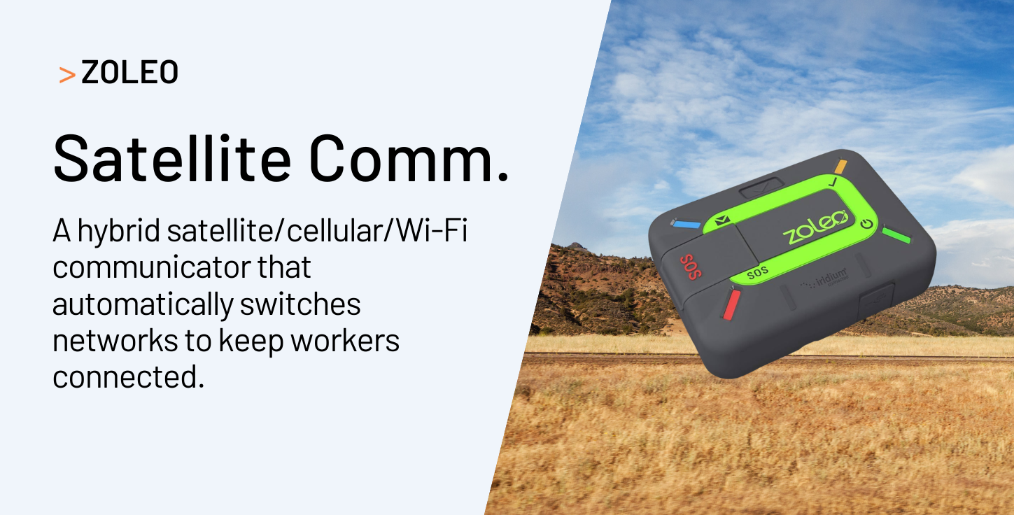
ZOLEO offers seamless global messaging by integrating Iridium satellite, cellular, and Wi-Fi networks, so the device automatically hands off between whichever network is available rather than relying on satellite alone. In emergencies, it provides two-way SOS alerting with 24/7 monitoring and precise location tracking to help responders dispatch quickly and accurately.
What sets ZOLEO apart in a journey management context is that hybrid connectivity model. Because it automatically falls back to cellular or Wi-Fi when available and only uses satellite when it has to, it can be a more cost-efficient option for teams whose routes are mostly covered but occasionally dip into dead zones — as opposed to teams operating almost entirely off-grid, where a pure satellite device like Garmin or SPOT may be a better fit.
4. Iridium GO! Exec
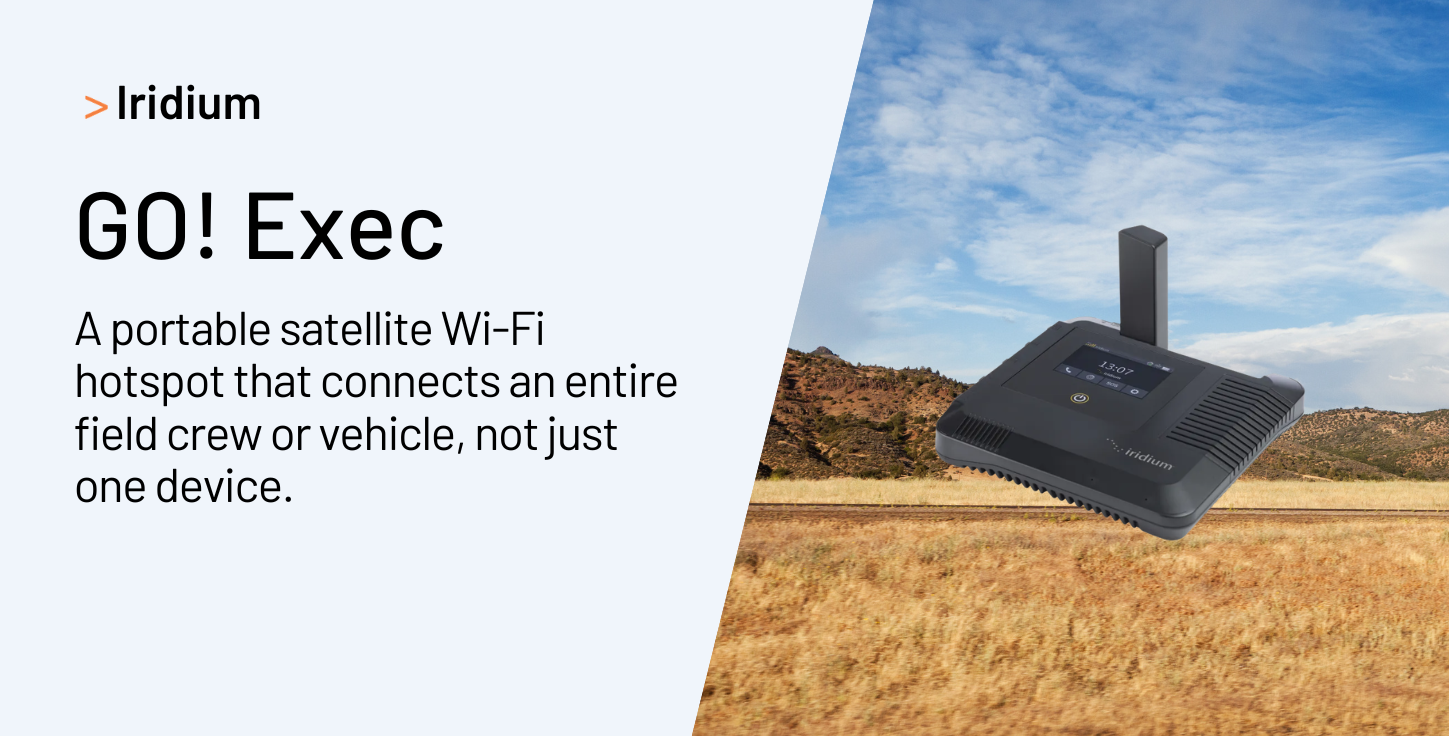
Iridium's GO! Exec sits a tier above personal communicators, designed to act as a portable satellite Wi-Fi hotspot for a vehicle, vessel, or field team rather than a single individual. It runs on Iridium's own satellite network — a cross-linked low-Earth orbit constellation that provides genuinely global coverage, including oceans and polar regions, with low-latency, weather-resilient connections.
For journey management programs supporting crews rather than solo workers — survey teams, drilling crews, marine operations — a shared hotspot-style device can be more practical than issuing individual communicators to every team member. It lets multiple devices and apps, including a journey management app on a supervisor's tablet or phone, connect through a single reliable satellite link. The trade-off is a higher unit cost and a device better suited to a vehicle or base camp than an individual's pocket.
5. Geotab GO9 (Vehicle Telematics)
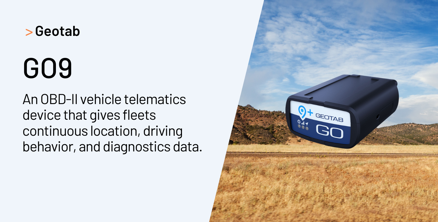
Where the previous four devices are personal or crew communicators, the Geotab GO9 represents the vehicle telematics side of journey management — the layer that tracks the truck or asset itself rather than the individual carrying a handheld unit. It connects directly to a vehicle's standard OBD II port with no antennas or wire-cutting required, and continuously gathers data on vehicle position, speed, and engine health.
Its GNSS module supports both GLONASS and GPS constellations, giving fleets greater location accuracy, faster time-to-first-fix, and more consistent data availability than older single-constellation devices. Internally, the GO9 was rebuilt with a more powerful 32-bit processor, along with substantially more memory and RAM than its predecessor, improving both longevity and the range of functions it can support. It can store up to 80,000 logs while offline out of cellular coverage, and its collision buffer captures more than 100 minutes of second-by-second data around a triggering event, instantly transmitting the last 1.2 minutes when an accelerometer-triggered collision occurs.
Geotab positions GPS asset tracking, combining satellite and cellular connectivity, as the standard for fleet vehicles and mobile equipment operating across multiple locations and geographies, in contrast to short-range Bluetooth tracking suited only to fixed indoor assets. For journey management programs managing vehicle fleets — not just individual field workers — this is the category of device that gives dispatchers continuous, high-fidelity visibility into where every vehicle is and how it's being driven.
Comparing the Top 5 GPS Systems for Journey Management in 2026
How to Choose the Right GPS System for Your Journey Management Program
Match the Device to the Worker, Not Just the Route
A single field technician making occasional site visits has very different needs from a survey crew spending weeks in remote terrain. Personal communicators like Garmin and SPOT are built for the former. Shared hotspot devices like Iridium GO! Exec are often a better operational and cost fit for the latter.
Think About Coverage Gaps on Your Actual Routes
Map your highest-risk routes and worksites against known cellular dead zones before choosing hardware. If your teams rarely leave cellular coverage, a hybrid device like ZOLEO may be more cost-effective than a satellite-only unit. If they regularly operate off-grid, satellite-first devices like Garmin or SPOT are the safer default.
Don't Separate Personnel Tracking from Vehicle Tracking
Many journey management programs make the mistake of tracking either the vehicle or the person, not both. A driver can step away from a vehicle that's still reporting its location perfectly. Pairing a vehicle telematics device like the Geotab GO9 with a personal communicator like a Garmin inReach gives dispatchers a complete picture, not just half of one.
Confirm the Device Integrates Cleanly with Your Journey Management Module
Not every GPS device feeds data into third-party safety software the same way. Before standardizing on a device across your organization, confirm it supports reliable, low-latency data sharing into your journey management platform, since a device that can't feed live location data into the system that's actually managing the journey provides limited safety value.
Bring Your GPS Data Into One Journey Management View
SafetyIQ's journey management module is built to work with the GPS and satellite devices your teams already carry — including Garmin, the most widely used device among our customers — so check-ins, route deviations, and SOS events all surface in one place for your safety team.
Frequently Asked Questions
What's the difference between a satellite communicator and a GPS vehicle tracker for journey management?
A satellite communicator, like a Garmin inReach or SPOT X, is a personal device that a worker carries with them. It's designed to track an individual, not a vehicle, and typically includes two-way messaging and an SOS button so the person can communicate directly with dispatch or emergency services if something goes wrong. A GPS vehicle tracker, like the Geotab GO9, is installed inside a vehicle and reports on the vehicle's location, speed, and driving behavior continuously, regardless of whether the driver has a personal device with them. For a complete journey management program, most organizations need both: the vehicle tracker confirms where the vehicle is and how it's being driven, while the personal communicator confirms the worker is safe even if they've stepped away from the vehicle, are working on foot, or the vehicle itself is disabled. Relying on only one of these creates a blind spot — a vehicle can be stationary and fine while its driver is in distress a hundred meters away, or a worker's phone can be tracking perfectly while the vehicle they're driving develops a mechanical fault that never gets flagged.
Why does satellite coverage matter so much for journey management, even if most of a route has cell service?
Journey management plans are built around the idea that if something goes wrong, the system will know quickly enough to act. That promise only holds if the tracking device keeps reporting no matter where the worker or vehicle is. Cellular-only devices work well in populated areas but go silent the moment a route passes through a dead zone — and dead zones are disproportionately common in exactly the environments where journey management matters most: rural highways, remote worksites, mining and forestry operations, and cross-border freight corridors. A worker who loses connectivity for even twenty or thirty minutes in a genuine emergency can be the difference between a fast, coordinated response and a delayed one. Satellite-capable devices, whether satellite-only like Garmin and SPOT or hybrid like ZOLEO, close that gap by maintaining a connection regardless of terrestrial network availability. Even organizations whose routes are mostly within cellular coverage often find it worthwhile to standardize on satellite-capable hardware simply because the cost of a single missed emergency far outweighs the marginal cost difference between device types.
How often should a GPS device report location during a managed journey?
The right reporting interval depends on the risk level of the journey, not a single universal number. For lower-risk, well-supervised routes, a 10 to 30 minute reporting interval is often sufficient to confirm general progress and catch major deviations without draining battery life too quickly — this is roughly the range most personal satellite communicators, including Garmin's inReach line, are built around by default. For higher-risk journeys — solo travel through remote or hazardous terrain, night driving, or operations in areas with known safety incidents — organizations typically shorten that interval and pair it with more frequent scheduled check-ins, since faster reporting means faster detection if someone stops moving unexpectedly or goes off-route. It's worth noting that shorter intervals come with real trade-offs: more frequent transmissions use more battery and, on some satellite plans, more data allowance, so the interval should be a deliberate choice based on the specific journey's risk profile rather than always set to the fastest possible setting. Many mature journey management programs build in different default intervals for different route risk tiers, rather than using one setting across the entire organization.
Can GPS and satellite tracking devices integrate directly with a journey management platform like SafetyIQ?
Yes, and this integration is what actually turns raw location data into an operational safety tool rather than just a map with a dot on it. Modern satellite communicators and vehicle telematics devices are generally designed to push location, check-in, and SOS event data out through an API or a companion platform, which a journey management system can then ingest to compare against a worker's or driver's planned route, expected check-in schedule, and defined risk parameters. When that connection is set up correctly, a missed check-in, an unplanned stop, or a route deviation can trigger an automated alert to a supervisor or safety team in near real time, rather than relying on someone manually watching a tracking map. The specifics of integration vary by device and by journey management platform, so it's worth confirming with both the hardware vendor and the software provider exactly how data flows between the two — including how quickly location updates are delivered, what happens to that data during a coverage gap, and whether SOS or emergency events are prioritized for faster delivery than routine location pings.




See how SafetyIQ helps simplify EHS management and builds a stronger safety culture.

.png)

.png)